


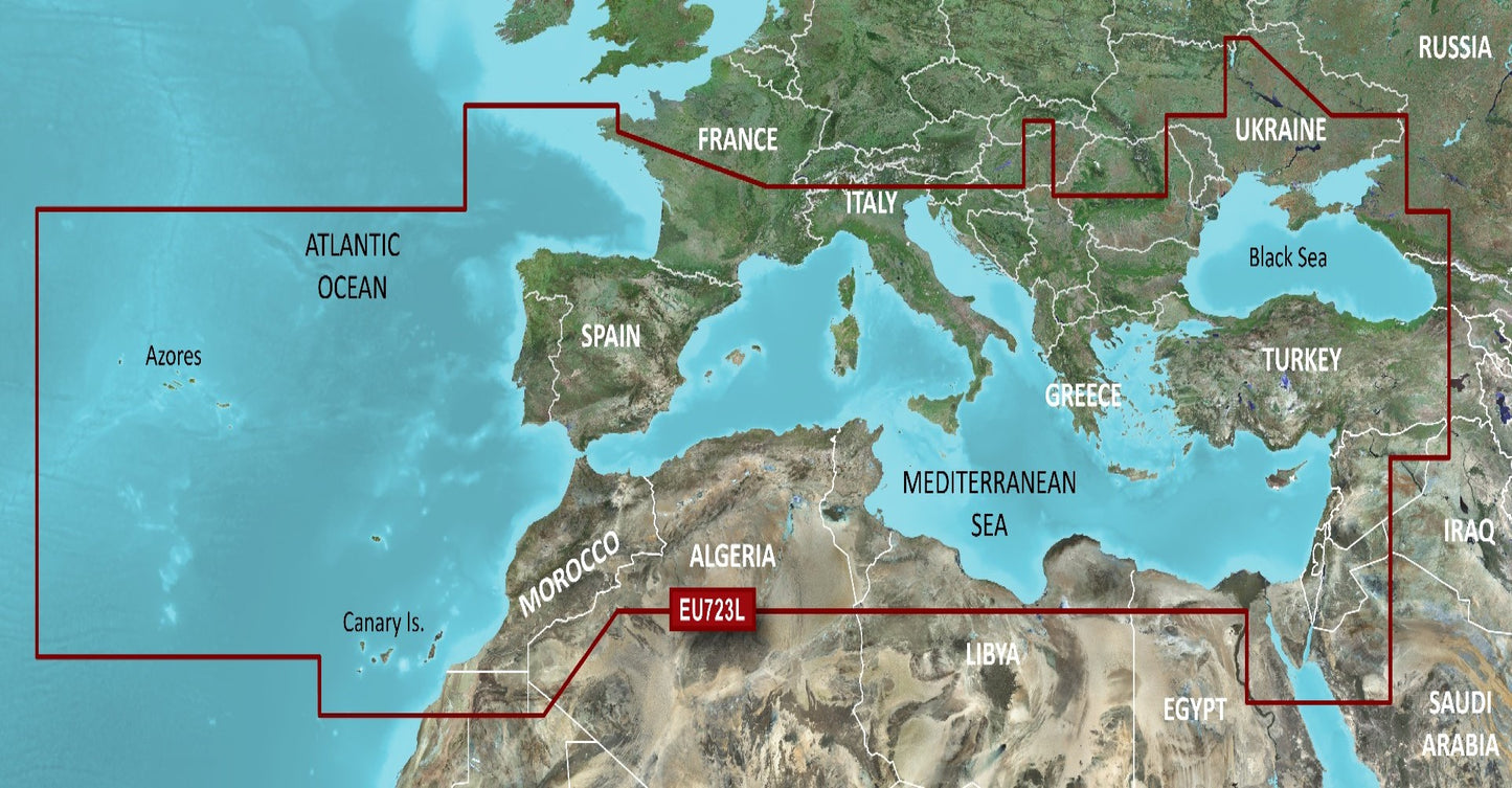
Garmin BlueChart G3 Vision Large Area - VEU723L Southern Europe
Garmin BlueChart G3 Vision Large Area - VEU723L Southern Europe
SKU:230-010C115700
Couldn't load pickup availability
Garmin BlueChart G3 Vision
Premier coastal charts
- Industry-leading coverage clarity and detail with new charts that feature integrated Garmin and Navionics content
- Auto Guidance1 quickly calculates a suggested route by using your desired depth and overhead clearance
- Includes Depth Range Shading for up to 10 depth ranges enabling you to view your target depth at a glance
- Up to 30 cm (1 ft) contours provide a more accurate depiction of the bottom structure for improved fishing charts
- To give a clear picture of shallow waters to avoid the Shallow Water Shading feature allows for shading at a user-defined depth
Experience unparalleled coverage and brilliant detail when you\'re on the water. BlueChart G3 Vision coastal charts provide industry-leading coverage clarity and detail with integrated Garmin and Navionics content.
Auto Guidance
Whether you are fishing or cruising select a spot and get a route showing you the general path and nearby obstructions at a safe depth.
Depth Range Shading
This feature displays high-resolution Depth Range Shading for up to 10 depth ranges so you can view your designated target depth.
Shallow Water Shading
To give a clear picture of shallow waters to avoid this feature allows for shading at a user-defined depth.
Detailed Contours
BlueChart G3 charts feature 30 cm (1 ft) contours that provide a more accurate depiction of bottom structure for improved fishing charts and enhanced detail in swamps canals and port plans.
High-resolution satellite imagery
High-resolution satellite imagery with navigational charts overlaid gives you a realistic view of your surroundings. It\'s our most realistic charting display in a chartplotter — ideal for entering unfamiliar harbors or ports.
FishEye view
This underwater perspective shows 3D representation of bottom and contours as seen from below the waterline. Interface with sonar data for a customised view.
MarinerEye view
This view provides a 3D representation of the surrounding area both above and below the waterline.
Aerial photography
Crystal-clear aerial photography shows exceptional detail of many ports harbours and marinas and is ideal when entering unfamiliar ports.
Compatible with the Garmin GPSMAP and ECHOMAP series Chartplotters.
¹Auto Guidance is for planning purposes only and does not replace safe navigation practices. Auto Guidance is not included in preloaded BlueChart g3 for ECHOMAP™ Plus series chartplotters
Let customers speak for us
Great price and quick delivery

I have lost quite a bit of contrast vision (54 years on insulin probably to blame). These have made it easier - much easier - to follow a golf ball's flight in the air. Sadly not always an unalloyed pleasure! But that's not the glasses' fault! Good pricing and quick delivery. 👍⛳️🏌️♂️

Great service excellent product
(redacted)

Great service :)
Great service from order to delivery thanks

Best price in UK

These boards are avalible from multiple suppliers, however water world sports were very competitive and had great delivery options.

Simple task to select and order from a clear and concise web site and in addition a Very prompt delivery.

Quick delivery. My first foil kite, well made and easy to fly. Handles gusty conditions and delivers a good amount of pull in strong winds but not overwhelming. Loads of fun for beach holidays!

Boots exactly as advertised in length.
Many thanks
Had a couple of items from Waterworld and both have been competitively priced and delivered in a very quick time. I'm happy so far.

Thanks for dispatching my goods quickly. All arrived as promised.

Beaver Standard Size Latex Neck Seal

Excellent service and good quality items
